Photogrammetric Surveys

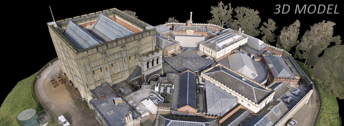
Aerial surveys offer a great way of covering large areas of land, whilst maintaining high resolution and high-quality data.

Skeye use the latest drone and camera technology to fly pre-programmed flights and capture high resolution still imagery. Further data is captured by ground teams to ensure that the data is tied into the correct coordinate system. Full survey verification is performed to provide confidence on the accuracy of the final deliverables.

Skeye is specialised in aerial photography at low heights, with geometrically calibrated cameras. This enables Skeye to obtain all heights of a surveyed terrain.


Photogrammetry is the science of combining multiple overlapping images to create a single overview image and 3D model of an area or object. Skeye use this technique by capturing overlapping imagery from cameras mounted on drones. The drone can be flown manually or pre-programmed to follow a defined route along which the camera takes images at defined points. This data is passed on to data processing teams in our offices who then process this data to produce single overview images and 3D models. By combining data with GPS control from the site the team can produce data with known levels of accuracy which are reported alongside the data delivery.

Photogrammetric surveys can be obtained using Skeye’s manned aircraft or unmanned aircraft.

The output file formats from this process can be varied and offer clients a great deal of versatility and insight. Data can be viewed in almost any GIS or CAD software package.

Related posts

Photogrammetric Surveys

Read more

LiDAR

Read more

3D Visualisation

Read more